
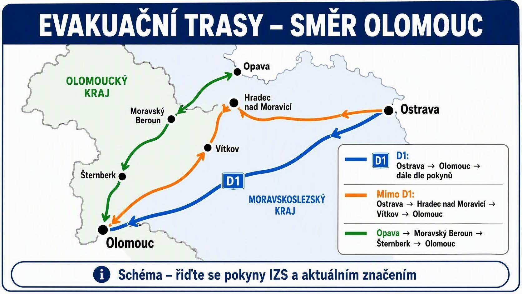
An infographic map has recently been circulating online, purporting to show road detours and alternative routes between the Olomouc Region (Olomoucký kraj) and the Moravian-Silesian Region (Moravskoslezský kraj). The graphic traces three main paths: one along the D1 highway, and two secondary detour routes (“Mimo D1” and a green-highlighted route) passing through towns such as Opava, Vítkov, Hradec nad Moravicí, and Šternberk. However, a closer look reveals that this map does not represent a current emergency or official traffic overhaul, and using it to claim widespread blockades or structural changes to the Czech road network is misleading.
Why the Map Is Unreliable or Taken Out of Context
Cartographic and Geographic Inaccuracies:
The regional boundaries shown and the proportional distances between towns (such as Opava, Šternberk, and Moravský Beroun) are heavily simplified and do not match official topographic maps or real road layouts managed by the Czech Road and Motorway Directorate (ŘSD).
Misuse of Local Context:
The Czech phrasing (“dále dle pokynů” = follow further instructions; “mimo D1” = off/outside the D1) indicates that this graphic was created at most as a simplified diagram for a localized event, temporary roadwork, or specific exercise. Presenting it as a general emergency measure or permanent highway change strips it of its original context.
Lack of Official Verification:
Neither the Police of the Czech Republic nor national traffic authorities have issued advisories matching the long-distance detour schemes shown on this map.
Conclusion:
The image is a decontextualized, simplified diagram. Readers are advised not to share the graphic as news and to rely instead on official traffic portals (such as Mapy.cz or dopravniinformace.cz) for real-time, accurate highway information.